OS Land-Form Panorama Contours in DXF Converter
The Land-Forma Panorama Contour data available free as OS Opendata is only in DXF format. This does not alway import correctly into GIS programs so use this free program to convert the DXF data into MapInfo Import Format (MIF/MID) or Shapefiles. Grid lines are optional and the marginalia is not converted so the data will tile seamlessly.
Download and Install Land-Form Panorama Contour DXF Converter Download the zip file and unzip the contents into a temporary folder. Important: If you are running XP, you must have Service Pack 3 installed before attempting to install Land-Form Panorama Contour DXF Converter. It can be downloaded from Microsoft here Run the downloaded file setup.exe
to start installation. You may see a message saying the publisher
cannot be verified - that's OK, just go ahead with the installation. The
program will by default create a folder and install itself. If you do not
have the latest .net framework files required they will be downloaded
automatically from Microsoft (note: this make take some time but will
only be required once) You can install Land-Form Panorama Contour DXF Converter on multiple PCs. It may be distributed to others but not sold. Example Landform-Panorama Contour DXF file converted to shapefile format (grid lines are optional): Click for larger image | 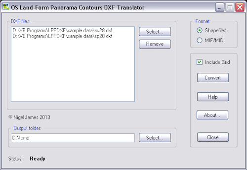 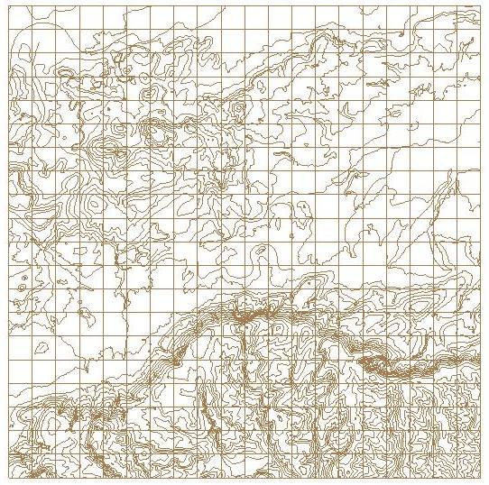 |