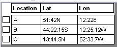
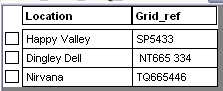
Conversion Tools - MapInfo coordinate conversion tool Version 4.0 for MapInfo Version 8.5 Conversion tools is a tool for MapInfo which converts tables of lat/lon coordinates into decimal degrees creates points in one click! It also converts British and Irish OS National Grid references to metres and plots the points. NOTE: This program is now legacy-ware and will not be updated. It will not run under later versions of MapInfo Latitude/Longitude coordinates can be in: OS National Grid coordinates can be in conventional form: i.e: two letters and 2-8 digits (one letter for Irish Grid coordinates)
The above examples show the formats which can be converted. Mixed forms are OK - each will be converted to the appropriate precision. A single point can also be converted and plotted by entering a lat/lon coordinate pair or a single grid reference To install Conversion Tools, download and unzip the file into your MapInfo tools folder (or another location if you prefer). In MapInfo, open the Tools menu and click Tool Manager. Click the Add Tool button and locate the saved mbx file. Give the tool a title (as below) - a description is not necessary: 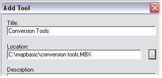 In Tool Manager, click BOTH checkboxes, then OK. Conversion Tools will then be added to the menu bar and will be loaded automatically each time you use MapInfo: 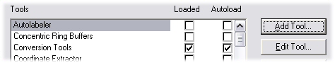 |
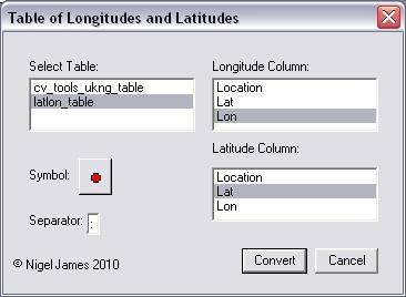  Remember that if you open a file from an external source, such as Excel, you must save a copy of the table and convert the copy, as the original file will be read-only.
This tool was developed for MapInfo versions up to 8.5. It is not guaranteed to be compatible with later versions
|